Digital Sub-sea Surveying to BIM
Waldeck have developed a new digital sub-sea monitoring product and risk management solution for the Ports & Maritime and the Offshore Oil & Gas industry.
This offering is primarily comprised of an integrated blend of 3D Laser Scanning, Photogrammetry and Hydrographic Surveying assembled and rationalised through our offshore solutions capability within our Digital Twin offering. This provides a safe, cost effective solution to our clients’ problems, while maintaining industry-leading procedures and processes.
To obtain the best results for our clients, Waldeck ensure our experts have a clear understanding of the project and its requirements from the point of consultation.
Waldeck are able to offer clients this sub-sea surveying method, which includes services such as:
- Existing structure surveys
- Seabed and sub-seabed surveys
- As-Built documentation
- Deformation monitoring
- Pre and post development sub-sea surveys
- Large scale sub-sea surveys
- Detailed ground models for use in Flood Risk Assessments
- Difficult, restricted or potentially dangerous environments
Through the efficient combination of these proven digital technologies and new capabilities, we are able to provide solutions for sub-sea surveys throughout the lifecycle of a project, providing a number of benefits for clients, including: low cost solution, fast data capture, time and cost savings and complete site coverage.
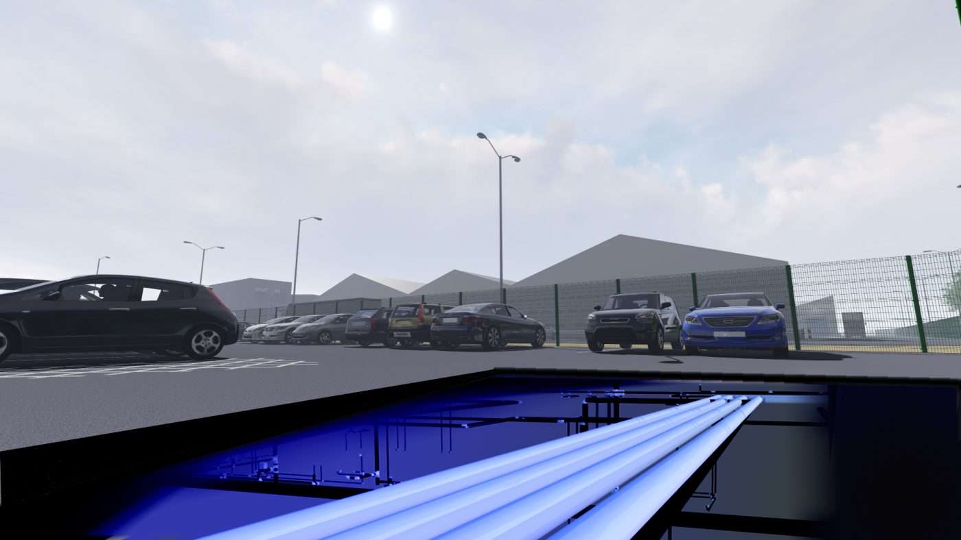
Digital Sub-surface Surveying to BIM
As the construction industry continues to develop, particularly in its digital advances, Waldeck have embraced the latest 3D survey, digital capture methodologies and techniques, enabling us to offer a total digital-based surveying and validation method for our clients, ensuring compliance with PAS:128.
Aligning Photogrammetry and Point Cloud solutions with PAS:128, we are creating a recognised level of methodology, accuracy and accountability, which provides precise and comprehensive information for our clients.
This offering is primarily comprised of advanced Photogrammetry, 3D Laser Scanning, Electromagnetic Locators (EML) and Ground Penetrating Radar (GPR).
Through the efficient combination of proven digital technologies and new capabilities, Waldeck are able to offer clients this digital sub-surface surveying method, which includes services such as:
- Record data models
- Digital validation through 3D laser scanning and photogrammetry
- Accurate build-up of the sub-surface using GPR and EML
- Pre and post development sub-surface surveys
- Federated geospatially coordinated 3D model output
Adopting Photogrammetry and 3D laser scanning in line with the traditional sub-surface surveying methods; EML and GPR, creates considerable benefits, which include: Health and Safety and CDM compliance, reduced risk, ‘Intelligent Customer’ status improved, less construction risk through reduced unknowns, better and more informed design solutions, leading to time and cost savings too.
For more information on Waldeck’s digital surveying capabilities, please contact Paul Waldeck by calling 08450 990285.